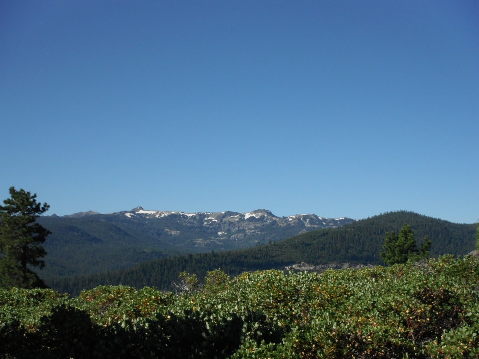
The first rays of the morning sun painted a gentle orange on
intermittent walls and spires, while the rest of the landscape remained
shadowed, still sleeping. I followed five dauntless women down the precipitous trail,
steeped in beauty and giddy with the day’s planned adventure.
“This must be ladies’ day for the rim to rim to rim!” The hiker
called out as I passed.
“Why, yes! It is!” I replied with enthusiasm.
Clearly springtime in the
Grand Canyon sees many an
ultrarunner make the double crossing. This was my first time to the park
though, and only two miles in I was already blown away by my surroundings,
falling off the back end of the group because I couldn’t put my camera away.
Jamie and I had been planning this trip for nearly a year.
After two incredible
experiences running in Zion, we decided it was time for a
new canyon. In many ways, I think we did the progression right. While the red
walls of Zion are quite dramatic, the Grand Canyon boasts much of that same
drama, and the overall scale is just more, well …
grand. A gash in the Earth’s crust so enormous, it’s difficult to
comprehend.
We parked the van at the top of the
Bright Angel Trailhead and hopped on the shuttle to the
South Kaibab where we would begin our run. Betsy ran around the shuttle painting glitter on all our faces while Caren promised not to run too far ahead on the trail. Jenelle, the sandbagger of the group, confessed her fears that she might not make it. Clare, Jamie and I just laughed and wiped the glitter out of our eyes. It was the perfect group of women for a new adventure.
 |
| Our awesome group at the top of South Kaibab, minus Jenelle who took the photo. |
We got a late start (6:20 A.M.) due to the need for the shuttle, but the weather was glorious. We negotiated the passing of two mule
trains (The mule drivers were quite considerate and helpful in allowing us to
pass.), and soon had the trail all to ourselves. I had to alternate between
staring around, awestruck, and keeping an eye on my footing, as we plummeted
through multi-colored layers of rock toward the Colorado River below.
 |
| I love the South Kaibab Trail! (Photo by Jenelle Potvin) |
 |
| Of course we would never attempt that! |
 |
| Still loving the South Kaibab (Photo by Jenelle Potvin) |
 |
| Jenelle passes the mules. |
By 8:00 we’d crossed the bridge and found our way to Phantom
Ranch to refill water, taking a little time to use the bathrooms and stash
extra gear for the return trip. Although our approach to the run was fairly
relaxed, we also knew we couldn’t do too much dawdling. In spite of our 3:00
A.M. wake up call, we would probably be finishing in the dark.
 |
| Colorado River |
The North Kaibab trail leaves Phantom Ranch along the Bright
Angel Creek, bound for the North Rim of the canyon. The first several miles
feature steep canyon walls, and a pitch that is quite runnable. The desert was
just beginning to assert its warmth while we crisscrossed the creek on several
footbridges. The canyon, as the day, lay before us filled with promise and adventure.
 |
| (Photo by Jenelle Potvin) |
Shortly after 9:30, I’d caught up to most of the group when
our promising day turned into a very challenging one. I looked up from the
trail to see Betsy on the ground, clearly in pain. She’d fallen, and it only
took us a few moments to realize that her run was over.
The first plan was for her to limp back to Phantom Ranch
with Jenelle’s assistance to seek help at the Ranger Station. After a few
attempted steps, it became immediately clear this would not work; she could put
absolutely no weight on the leg, injured just below the knee.
We discussed our options: A) One person run back to get help,
one person stay with Betsy, and the rest continue? No one felt good about
continuing. B) Two people run to get help and everyone else stay? That seemed like
the best option. Meanwhile though, Jenelle discovered she had cell service
(Miracle! It was the only place in the entire canyon with service!) and was in
touch with a ranger named Adam at Phantom Ranch.
Much to Betsy’s dismay, it was decided that a helicopter was
probably the only option to get her out of the canyon. Adam needed to assess
the situation before making the final call and would walk to our location. The
waiting game ensued. Did you know that ultrarunners are not very good at sitting
around waiting for help? We called back and offered to run to the ranger
station and pick up a litter with which to carry Betsy out. There were five of
us, after all, and we’re tough. Apparently that was not an option. (Adam later
told us it was the first time he’d ever had such an offer.)
So, we waited.
We dipped our shirts in the creek to keep cool. We wondered
about the rest of the day. We worried about Betsy. We spent a good amount of
conversation discussing the potential hotness of our impending rescuer. I’ll
spare you the details, but suffice it to say our maturity levels regressed several
decades. Hysterical giggles are good therapy for sun-drenched brains and
worried hearts.
Eventually, finally, after possibly forever, Adam arrived.
And guess what?
He was totally hot.
He was also extremely kind, very professional, and made us
all feel much better about the eventual outcome of Betsy’s day. He confirmed
the need for a helicopter, and reassured us that she would be in safe hands.
 |
| Betsy and Hot Adam |
It was a strange and difficult thing leaving our friend on
the trail at the bottom of the Grand Canyon, (even though she was with probably
the hottest ranger in a 1,000 mile radius). We did not yet know the extent of
her injury (fractures at the top of the tibia and fibula, it turns out), but we knew she had
a rough road ahead.
After losing four hours to the rescue efforts, it seemed
that our double crossing was not going to happen. It was 2:00 P.M. and we had only gone 12
miles. We decided to continue up the North Kaibab Trail a few miles to visit
Ribbon Falls before turning around to head back to the South Rim.We were just glad Betsy was safe.
We bid farewell to Betsy and Adam, and continued up the
trail with heavy hearts. Our day of promise had turned out to be challenging in
ways I hadn’t expected. I felt horrible about Betsy, and I also felt
disappointed that we wouldn’t complete our goal of the full double crossing.
Betsy had tried to get at least some of us to keep running and not wait for
Adam, but we just couldn’t do it. I understood how she felt, but we were a
team, and it didn’t seem right.
In the weeks since this trip, the rest of us have given much thought and discussion to our running practices - all the times we run alone in the wilderness. There were a few hikers on the trail that day, so had Betsy been alone, she could have still gotten help, but it would have been much more difficult. Not to mention scary. I can't say I'm contemplating giving up running solo in the wilderness, but I've certainly become better already about making sure others know my plans.
Up the North Kaibab, the day was incredible and we had the trail mostly to
ourselves. We came quickly to the junction for Ribbon Falls and made the short
side trip. I love seeing lushness in the desert, and Ribbon Falls provided just
that. Water cascaded over red sandstone landing on a large rock below. The rock was slick with green moss, surrounded
by a pool flanked with trees and shrubs and grass. The day’s heat made
splashing in the water the perfect antidote for our stress.
 |
| Ribbon Falls |
 |
| Cooling off with Jamie at Ribbon Falls. (Photo by Jenelle Potvin) |
Back on the trail, and my brain began to churn. Why can’t we do the full crossing? What time
might we finish if we just keep going? We’re almost all 100-mile veterans; we
know what it’s like to run in the dark. We have headlamps. As we ran up the
trail, I quietly voiced these thoughts to Clare to gauge her reaction, and she
gave me an encouraging smile and nod of the head. Perhaps I wasn’t the only one
thinking these things?
While we’d been waiting for Adam, Jamie and I had promised each
other we would return to complete the rim to rim to rim in the fall. There
would be other days, we’d said. But now, other thoughts spoke in my head. I took two days off work to be here. We
drove 13 hours, and will have to do it again to get home. Just getting here
had been a challenge, and the idea of running a few hours in the dark was
starting to seem like less of a big deal the more thought I gave it.
Still, I wanted to be sure we were making smart decisions.
My husband works in search and rescue, and I am well aware that the two
thoughts I’d just had (time taken off work, and time to get to the destination)
were often factors in justifying stupid decisions. I did not want to be one of
the stupid people, so I thought carefully about how things might play out if we
continued all the way to the top of the North Rim.
When we finally discussed it as a group, there actually wasn’t
a whole lot of discussion. We were a little uncertain that we had as many
calories with us as we would like, but that was the only major concern. We all
wanted more miles, and we all had experience with running in the dark. We would
absolutely stick together, and that was that. We were going for it!
I can’t explain how incredible I felt after that decision
was made. We’d lost the canyon through circumstances no one could control, but
now we had it back. Our vanished goal again became attainable. Just knowing that
filled me with such energy; I knew we would make it.
The final miles to the top of the North Rim get steeper and
more spectacular as you climb. Now that we were on a tight time schedule, I
knew we couldn’t mess around too much. I also knew I wanted to breathe in every
moment of this run, every view, every hill, every rock formation. Now that we
were here, that we’d committed ourselves, I wanted to make sure it was all
worth it.
 |
| Jamie and Clare nearing the top of the North Rim. |
 |
| We made it! Jenelle celebrates the snowy North Rim. |
 |
| Clare and Jamie: "Uh, we're only halfway?" |
We took a few minutes at the top to eat food and let the
reality sink in that we were only halfway. It was 4:00 P.M., and time to turn
around. We knew it was going to be a long, long day.
 |
| Clare, heading back down the North Kaibab Trail. |
 |
| Clare and Jenelle pause on the descent. |
The run back down to Phantom seemed to go by in a flash. The
downhill felt easy, and we all tried to make as many miles as possible before
darkness set in. We turned on headlamps just a couple miles before the river
crossing.
Timing was perfect to grab a few snacks at the Phantom
Ranch, as the store re-opened at 8:00 P.M. – exactly when we arrived. Snickers
bars and lemonade put everyone in positive spirits as we headed out for the
final climb up the Bright Angel Trail.
We’d taken a shuttle in the morning so we could return via
this trail, rather than the South Kaibab which we’d taken down. We’d been hoping
for different scenery, which made us laugh now. Still, I reveled in the
darkness. This was our adventure. This was where we were. At the bottom of the
Grand Canyon in the pitch darkness, surrounded by unseen walls, and stars
peeking in overhead. I was thrilled!
At the back of the group, which is apparently my comfort
zone for some reason, I turned my light off in the middle of the bridge. The
river rushed past beneath me, and even though I couldn’t see the canyon walls,
I could feel them there. The absence of stars spoke their outlines with the
half moon about to rise over the rim. I knew it was going to be a slog up
Bright Angel. We’d been awake for 18 hours, I was already exhausted, and we
hadn’t even begun climbing. I knew all this, and I simply didn’t care. I still
felt triumphant that we’d completed our entire journey. Every tired,
sleep-deprived step, was now merely part of the experience.
The climb in darkness was more magical than I could have
imagined, although perhaps it was simply part of that same late-night exhaustion that eventually
induces hallucinations.
We saw wildlife everywhere. Frogs sang in these
incredible, deep choruses. When we finally spotted our baritone culprits at a
creek crossing, they were far too tiny to be making such noise, surely! We saw
docile deer, miniature scorpions, furry tarantulas, and one curious ringtail. I kept
seeing spiders with glittery eyes, but every time I pointed one out to Jamie or
Jenelle, they thought I was joking. I swear they had glitter in their
eyes! (I’m certain daytime hikers all
miss the glittery spiders.)
Near midnight, the final miles were completed in a steady
power hike. Although I was overwhelmingly happy, I was also far more tired than
expected for a 45 mile run.
“I keep thinking,” I confessed to Jamie as I walked behind
her, “that if this were Hardrock, I wouldn’t even be halfway.” The desperation
in my voice conveyed the thoughts behind that statement: I can’t even imagine running another 55 miles right now, and this isn’t
nearly the elevation gain or loss experienced at Hardrock, nor the altitude.
“I know,” she said. “I’m starting to wonder if I’m cut out
for some of the tings on my agenda this year.”
I knew exactly what agenda items she meant, and the glow
from my headlamp simply rose and fell in solidarity behind her.
“I love how we have no false words of comfort for each
other,” I laughed a moment later.
“There’s really no way to sugar-coat it,” she agreed.
We do have big adventures ahead in our year, but I think the
Grand Canyon set the tone. It was training in adversity, as well as
perspective. It was tragedy and triumph. It was glorious in so many ways, and
an experience with dear friends that I’ll never forget.
And I can hope, in another three months, that 45 miles won’t
seem nearly as long.
 |
| No one really felt inclined to pose for a group photo in the dark at the end, but this kind of captures how we felt, minus the sheer exhaustion. |